National Parks and Monuments 2016
Just about every summer we go up to the north end of Vancouver Island in BC, Canada. Back in the days when I still had a job, the 1,600 mile journey up and back was made in three days to maximize my vacation time; these days we take it easy. This year we will be visiting Zion and Yellowstone National Parks on the way up.
 We started out going south to San Diego to see the kids and grandchildren, great visit with everyone & the granddaughters are growing up fast & both are just as cute as a speckled pup and fun to be around – most of the time…. That’s an entire conversation in just a glance; and you can bet mischief is in there somewhere.
From San Diego we headed for one of my favorite places to ride a motorcycle, southwestern Utah. Seeing the area from the cab of a pickup isn’t nearly the experience you get from being on a motorcycle but it’s still not bad. We stayed at the KOA in Hurricane, Utah. The city of Hurricane (pronounced Hur-a-cun by the locals) got it’s name when one of the early settlers had the canopy blown off his buggy. He said, “Wow that was a hurricane, we’ll call this place Hurricane Hill.” And, true to it’s name, it was pretty dang windy during our stay.
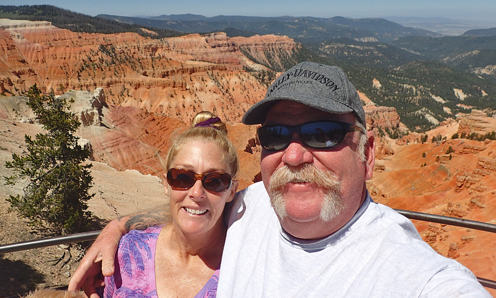 We drove north out of our KOA headed for Cedar Breaks National Monument. Cedar Breaks is a natural amphitheater, stretching across 3 miles, with a depth of over 2,000 feet. I’ve been to Cedar Breaks at least three times and never realized just how high up it is. The rim is over 10,000 feet which meant that compared to Hurricane – it was COLD up there. Cold enough in fact that we were out of the truck long enough to take a quick look around and get this shot and get back in my truck where it was warm.
From Cedar Breaks we headed for Bryce Canyon, which despite its name, is not a canyon, but a collection of giant natural amphitheaters along the eastern side of the Paunsaugunt Plateau. Bryce is distinctive due to geological structures called hoodoos, formed by frost weathering and stream erosion of the river and lake bed sedimentary rocks. The red, orange, and white colors of the rocks are really spectacular.
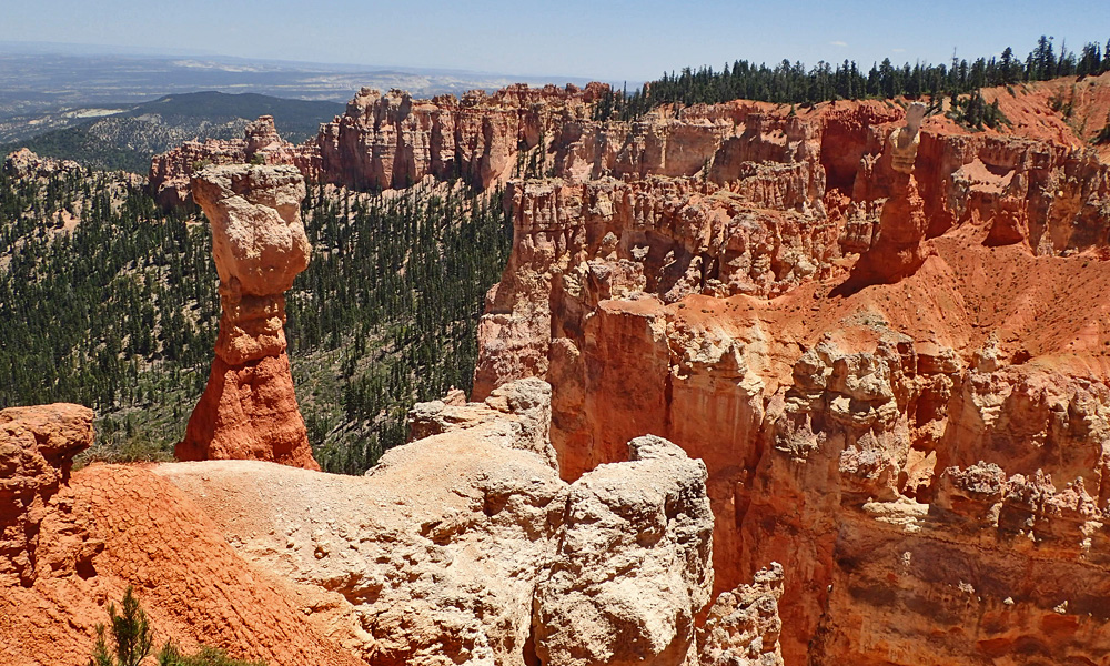
The Bryce Canyon area was settled by Mormon pioneers in the 1850s and named after Ebenezer Bryce, who homesteaded in the area in 1874. The area around Bryce Canyon became a National Monument in 1923 and was designated as a National Park in 1928.
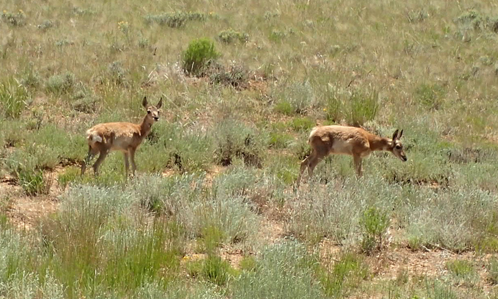
As we were driving out of Bryce Canyon we saw this pronghorn antelope family grazing on the side of the road, there was even a little baby. I say family, but the daddy was nowhere to be seen. Those guys are wary!! Regardless, this is the closest I’ve been to a pronghorn antelope in the wild.
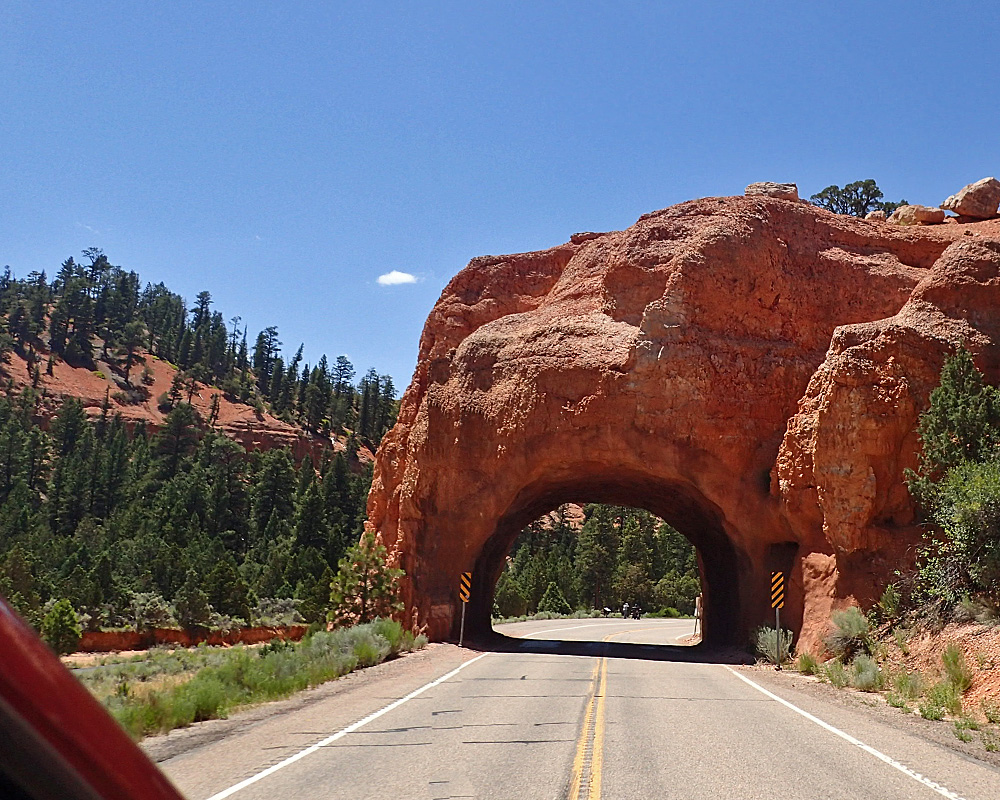
We left Bryce Canyon and headed for Zion National Park. Along the way there were a couple of these tunnels cut in the sandstone. I gave Robin the camera to take this picture because she gets a little nervous when I’m trying to drive and do photography at the same time. However, in order for her to be able to get a better picture, I was driving down the middle of the road – nice shot though, doncha think?
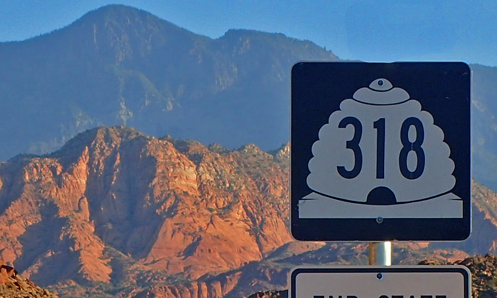 Something I’ve noticed and was curious about was why the county road signs here in Utah have beehives as a background. I put my crack investigator on it and here is what she came up with. Utah is “The Beehive State” but it has nothing to do with actual bees or the production of honey. The Bible refers to the Promised Land as the Land of Milk and Honey. This, and the cooperative work and lifestyle of bees led Brigham Young to name their 1847 Salt Lake Valley settlement “Deseret” or “honey bee” in the language of the Book of Mormon; and to name the beehive as it’s symbol. Learn something every day….
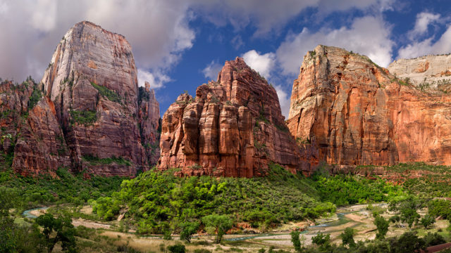
I definitely saved the best for last today. Zion National Park is a very cool place. Not temperature wise – it’s kinda hot there this time of year but it’s probably like nothing you’ve ever seen before. It’s a narrow road cut by water running through huge sandstone cliffs millions of years ago. The erosion is still going on and you can see it in the small piles of sand along both sides of the road.
Zion National Park is 229 square miles of canyons cut deeply through the reddish and tan colored Navajo Sandstone by the North Fork of the Virgin River over the last 13 million years. Human habitation of the area can be traced back 8,000 years. Mormons came into the area in 1858 and settled there in the early 1860’s. In 1909, President Taft, named the area a National Monument to protect the canyon, under the name of Mukuntuweap National Monument. In 1918, the acting director of the newly created National Park Service changed the park’s name to Zion, the name used by the Mormons. The United States Congress established the monument as a National Park on November 19, 1919.
Zion is a word that is referenced in many religions and has many different definitions. Roughly translated, Zion is a holy meeting place. It’s easy to see how people would think of this area as a holy meeting place. The grandeur and beauty brings about a peaceful feeling; from there, reverence and contemplation are pretty easy to get to. It’s much like walking into a beautiful cathedral. I highly recommend visiting if you’re ever in the area.
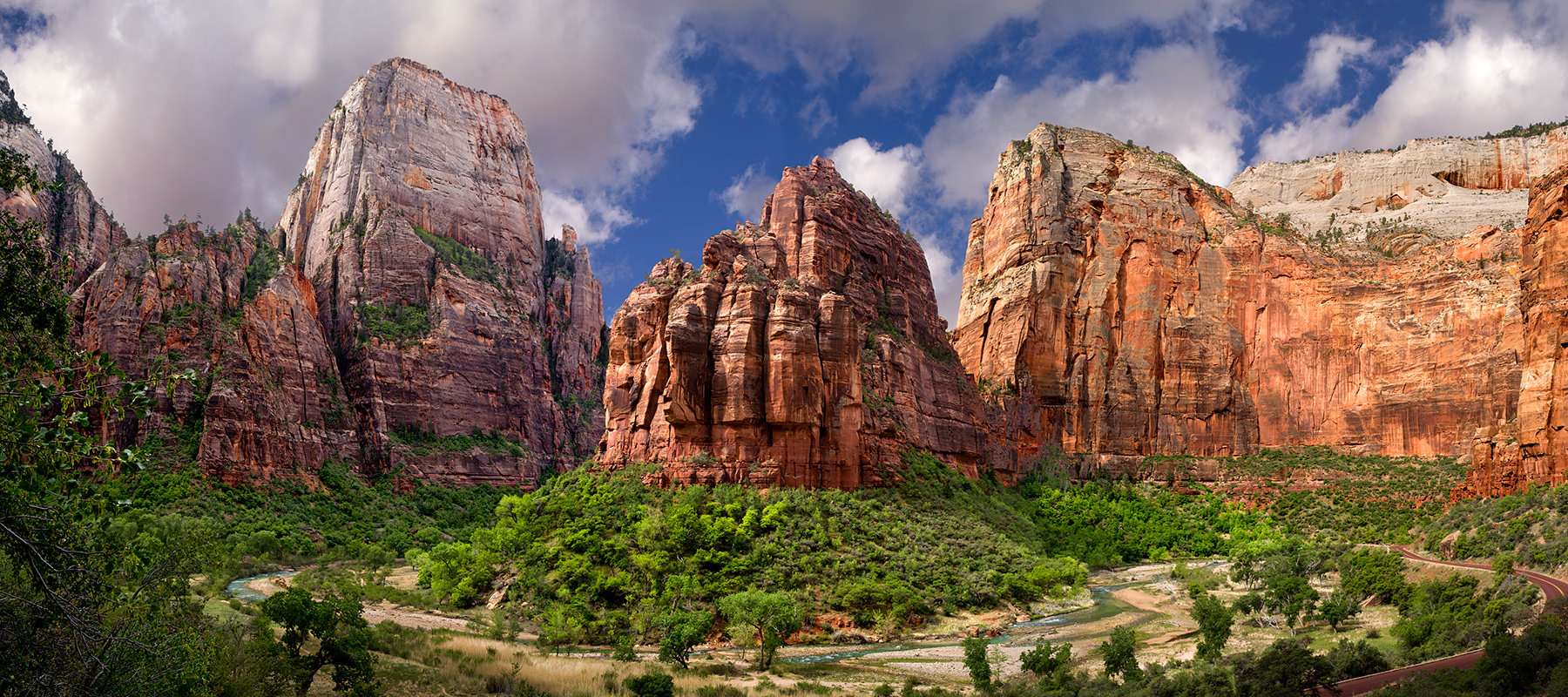
Zion is a place that you’re kinda down inside vs. the Grand Canyon that you look down into. I’ve tried but I haven’t been able to take a picture that even comes close to capturing the grandeur of the place. So I’ll just tell you that it’s definitely worth the trip and share an image that I got off the Internet.
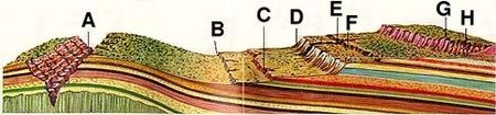
Zion is near the middle of a geological area called the Grand Staircase. In the 1870s, a geologist conceptualized this region as a huge stairway ascending out of the bottom of the Grand Canyon northward with the cliff edge of each layer forming giant steps. History written in stone. Grand Canyon (A), Chocolate Cliffs (B), Vermilion Cliffs (C), White Cliffs (D), Zion Canyon (E), Gray Cliffs (F), Pink Cliffs (G), Bryce Canyon (H).
 For more information on the Grand Staircase, check out this link.
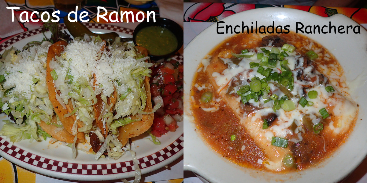
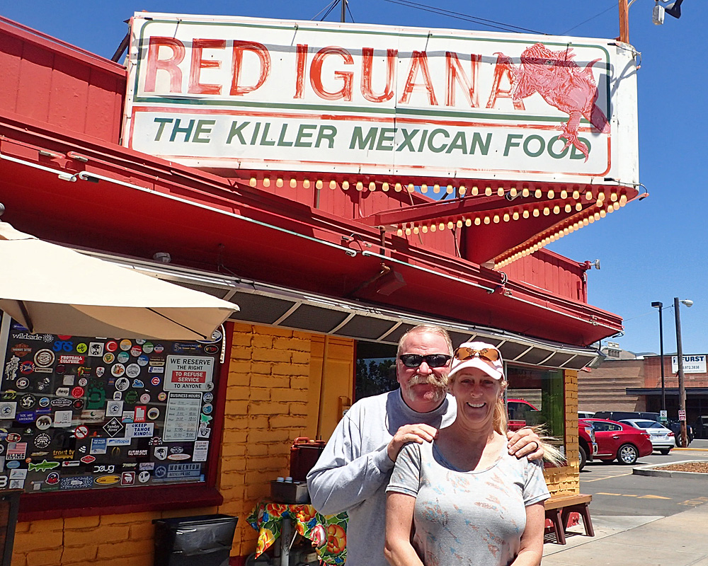 I had planned to go back and explore Zion a little more since all I’ve ever really done is just drive through the place, but it was very crowded and almost no place to park so that’s going to have to be a motorcycle thing down the road sometime. Instead, we headed for Salt Lake City and a place I’ve been wanting to eat since I first saw the place on Diners Drive-Ins & Dives back in 2013. The Red Iguana is a very popular restaurant near the center of the city. We got there at 2:00 on a Wednesday afternoon and there was a 15 minute wait. The food was well worth the wait!! They are famous for their Mole sauces but we’ll have to try those when we come back to see the rest of Zion. What we did have was outstanding. And I can tell you that this won’t likely be the last time I enjoy their fine food. P.S. The margaritas ain’t half bad either…
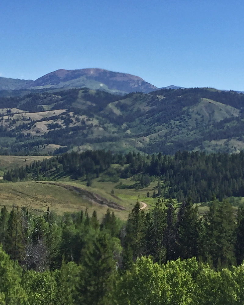 The next day we were headed for Idaho and the Craters of the Moon National Monument. I’d never even heard of the place before but as long as we were in the area, what the heck. The scenery up here could easily be referred to as breath taking.
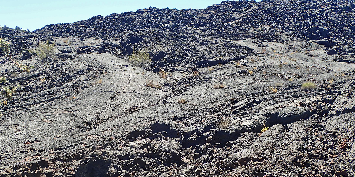
Craters of the Moon National Monument and Preserve is located in central Idaho. It was established in 1924 and in 2000, President Clinton greatly expanded the Monument area. The Monument and Preserve encompass three major lava fields and about 400 square miles of sagebrush steppe grasslands, a total area of 1,117 square miles. The lava didn’t come from volcanoes, it came from a rift or tear in the crust of the earth – and there is a LOT of lava. They say that the temperature can get to 170° – luckily for us, it was actually quite comfortable while we were there.
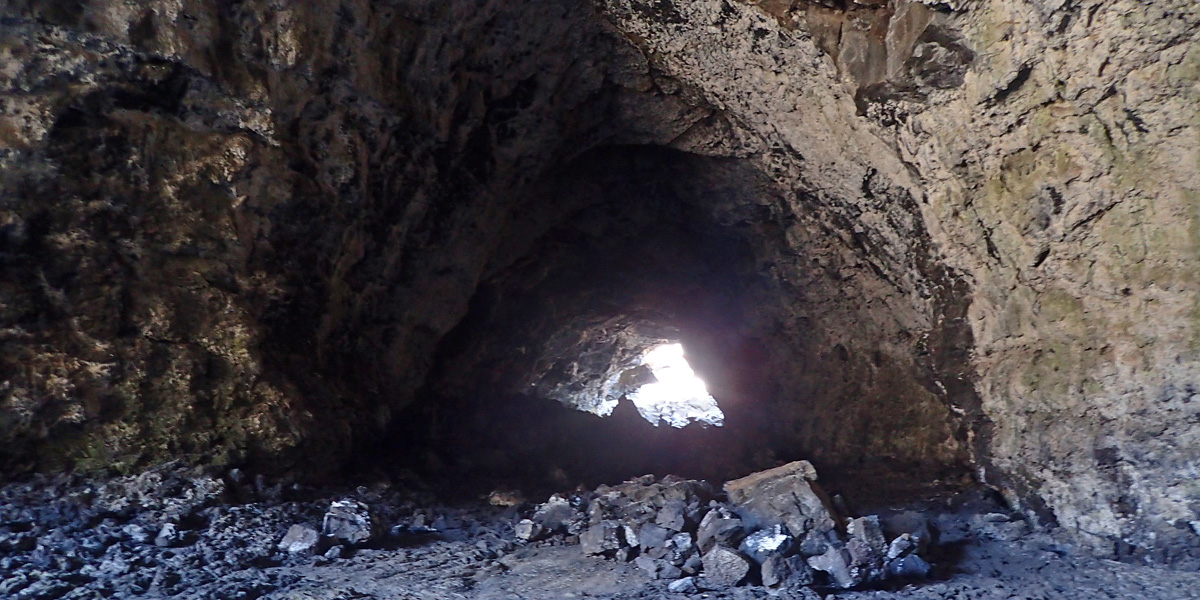
Other than the lava, which pretty much looks the same, the lava tubes are worth seeing. Lava tubes are created when the lava on top of a flow hardens but the lava keeps flowing underneath in a “tube” of molten rock. I’ve seen lava tubes on TV but these tubes are huge maybe 50 feet across and 40 feet high – that’s a lotta lava.
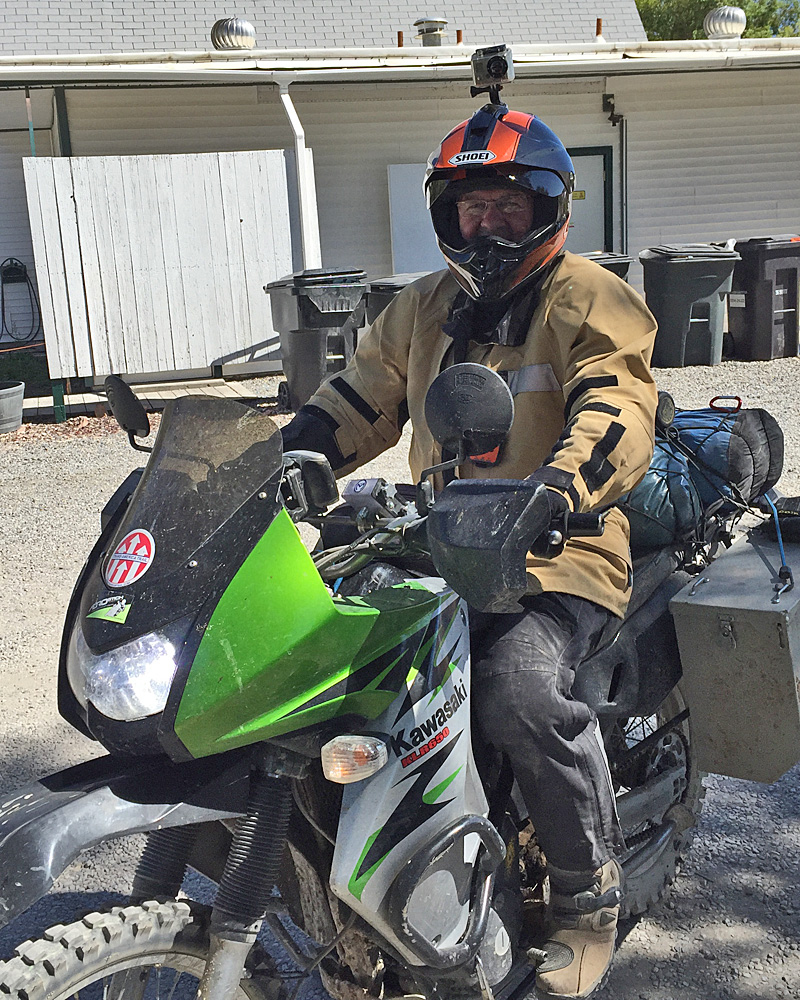 Our first evening in the Arco, Idaho KOA we were sitting outside enjoying the cooler weather when this guy rode up on his motorcycle. He ended up camping 30 yards or so in front of us. While he was unpacking his bike and getting his tent set up I walked over and introduced myself (his name is Pat) and invited him over to our site for a comfortable seat and an ice cold beer.
 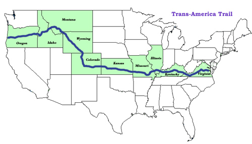 After he got all set up he came over and we talked bikes and bike rides until bed time. He’s riding the Trans-America Trail which is dirt roads and motocross trails across the country. He also writes a blog about his trip, much the same as I do; if you’re interested here is Pat’s blog site: www.letsgomotorcycle.com. I’d like to ride that Trans-America Trail but I’m not confident enough in my dirt bike riding and dirt bike repair skills to do it alone. Hat’s off to you Pat and I’d like it very much if our paths were to cross again.
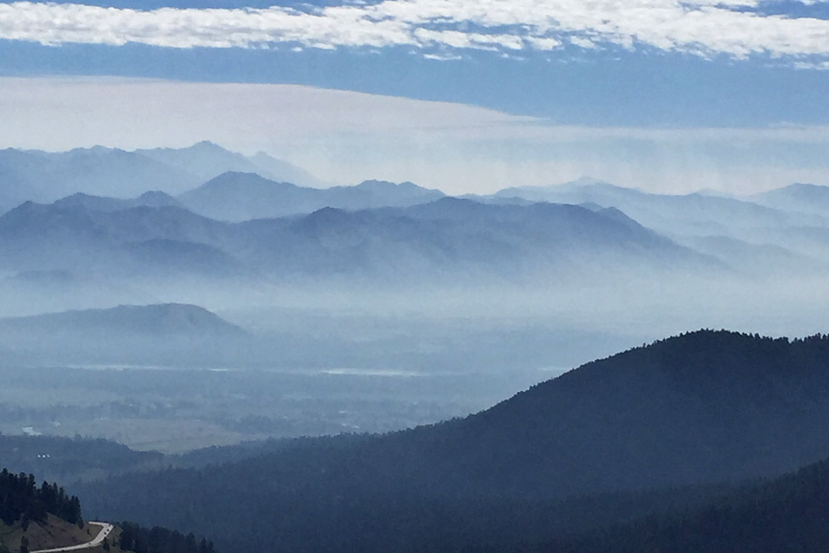 Okay — time to head for Yellowstone National Park. When we went into the park – we went through the south (Teton) entrance down by Jackson, Wyoming. With all the smoke around Jackson, we were glad we chose to stay in the West Yellowstone, Montana KOA.
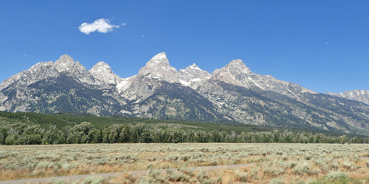
I picked this entrance because it goes through Grand Teton National Park before entering Yellowstone. The Teton Range is so spectacular because the eastern side of the range doesn’t have any foothills. Forty miles of jagged granite mountain peaks appear to climb straight up to their maximum height of 13,775 feet.
Great stuff. thank you both for sharing.
Bill Hunter
Ok little brother I’m reretired again let me know when you an to head out on the bikes again.
Beautiful!
Nice write up… You have a future as a travel writer.
Next time I see you we’ll talk about The Red Iguana.
It’s funny, Red Iguana was a usual chow run for the longest time and many of the folks in the room were so tired of it. Wish we could’ve been there to catch up a bit!!!
Jo and I really like you two,but your pictures and commentary are something else so if you don’t mind just stay on the road
I’m Hungry!!!!!!!